Managing our Environment

Kirkwoods Creeks Wetland Management Area

Description:

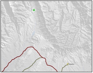
An area of valley floor boglands (tussock bogs and cushion bogs) within an altitudinal sequence of vegetation from the crest of the Hawkdun Range to the valley floor of Kirkwoods Creek, a tributary of the Manuherikia River. 1

Type/Class:

Fen 2

Size:

255.7 ha

Altitude:

720 - 920 m above sea level

Approximate location:

3 km North of the intersection of Home Hills Runs Road and Hawkdun Runs Road, Omakau.
NZTM (centre point): E1356000 N5040800

Regional Plan: Water for Otago

Schedule 9 Regionally Significant Wetland, no.73, Map F14.

Territorial Authority:

Central Otago District Council


Kirkwoods Creeks Wetland Management Area

Recorded Values:

Value

Description

A4

High degree of wetland naturalness. 2

A5

Scarce in Otago in terms of its ecological or physical character. Scarce wetland types: regionally threatened plant communities. The red tussock (Chionochloa rubra) and Sphagnum sp. cushion bog communities are described by Grove (1992 96). 1

A7

High diversity of indigenous wetland flora and fauna. The area supports a wide range of native species in a variety of habitats. 1

A1 - A3, A6, A8 A9

No relevant information is currently held by the ORC.


Other Information:

  • Described as an area of montane wetland that has formed with Sphagnum sp. bog in the middle and red tussock (Chionochloa rubra) bog-tussockland towards the margins. Other species found within this area includes sedge tussock (Schoenus pauciflorus), Uncinia fuscovaginata, Carex gaudichaudiana, star sedge (Carex echinata), swamp lily (Bulbinella angustifolia), Yorkshire fog (Holcus lanatus), sweet vernal (Anthoxanthum odoratum), Ranunculus gracilipes, piripiri (Gonocarpus micranthus), Gonocarpus aggregatus, king devil (Hieracium praealtum), combsedge (Oreobolus pectinatus), Pernettya nana, mountain daisy (Celmisia alpina), catsear (Hypochaeris radicata) and Polytrichum juniperinum. 38

  • Listed as an Area of Significant Indigenous Vegetation, Habitats of Indigenous Fauna and Wetlands in the Central Otago District Plan. 55


Aerial View of Kirkwoods Creek Wetland Management Area (April 2005)

Aerial View of Kirkwoods Creek Wetland Management Area (April 2005)

References:

1 Otago Regional Council (2004) Regional Plan: Water for Otago. Published by the Otago Regional Council, Dunedin.

2 Ausseil, A.G., Newsome, P., Johnson, P. (2008) Wetland Mapping in the Otago Region. Landcare Research Contract Report prepared for the Otago Regional Council.

38 Land Information New Zealand (2005) Crown Pastoral Land Tenure Review: Two Mile Pastoral Lease. Conservation Resources Report – Part 2 for the Commissioner of Crown Lands. Published by Land Information New Zealand, Wellington.

55 Central Otago District Council (2008) Central Otago District Plan, Published by Central Otago District Council, Alexandra.

Back to top
Online Maps & Data: