Managing our Environment

Coutts Gully Swamp

Description:

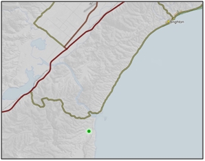
Fresh–brackish water swamp near mouth of Duckbend Creek, southwest of mouth of Taieri River. 1

Type/Class:

Swamp. 2

Size:

33.0 ha.

Altitude:

0 - 20 m above sea level.

Approximate location:

Southwest of the intersection of Moturata Road and Sawmill Road, Milton.
NZTM (centre point): E1382720 N4894260.

Regional Plan:

Water for Otago.
Schedule 9 Regionally Significant Wetland, no.87, Maps F42.

Territorial Authority:

Clutha District Council.


Coutts Gully Swamp

Recorded Values:

Value

Description

A1

Habitat for nationally or internationally rare or threatened species or communities. Australasian Bittern (Botaurus poiciloptilus) have been recorded at this site. 1

A4

High degree of wetland naturalness. 2

A5

Scarce in Otago in terms of its ecological or physical character. Less than 15% of swamps remain in Otago. 2

A7

High diversity of indigenous wetland flora and fauna. An interesting and diverse variety of wetland plant species. 1

A8

Regionally significant wetland habitat for waterfowl . Regionally significant habitat for waterfowl. Pied Stilt (Himantopus himantopus) and Spur-winged Plover (Vanellus miles novaehollandiae) breed in the area. 1

A2, A3, A8, A9

No relevant information is currently held by the ORC.


Other Information:

  • Composition of wire rush/oioi (Leptocarpus similis), pūkio (Carex secta), flax and gorse (Ulex europaeus). 2

  • A Wildlife Management Reserve in part (Sawmill Wildlife Management Reserve) and part in private ownership. 1

  • Significant Wetland in the Clutha District Plan. Described as salt rush and reed swamp, succulent herb swamp, rush and sedge swamp, with some tidal habitat. Also described as a rather conglomerate wetland, with some areas cleared or partially drained, and other parts still in dense vegetation. Excellent breeding and feeding areas. 37


References:

1 Otago Regional Council (2004) Regional Plan: Water for Otago. Published by the Otago Regional Council, Dunedin.

2 Ausseil, A.G., Newsome, P., Johnson, P. (2008) Wetland Mapping in the Otago Region. Landcare Research Contract Report prepared for the Otago Regional Council.

37 Clutha District Council (1998) Clutha District Plan. Published by the Clutha District Council, Balclutha.

51 Otago Regional Council – Photo Archive.

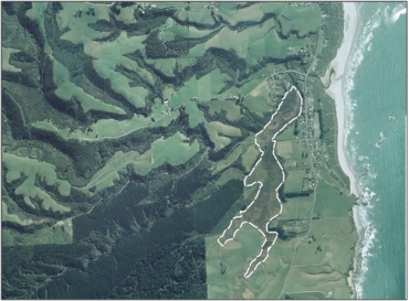
Aerial view of Coutts Gully Swamp (March 2006)

Aerial view of Coutts Gully Swamp (March 2006)


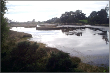
Coutts Gully Swamp (March 2011)

Coutts Gully Swamp (March 2011) 51


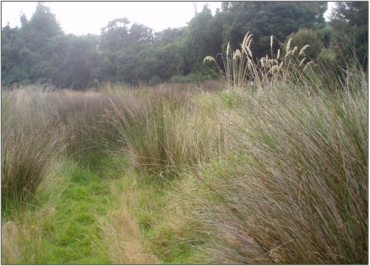
Coutts Gully Swamp (March 2011)

Coutts Gully Swamp (March 2011) 51

Back to top
Online Maps & Data: