Groundwater drilling set to uncover impacts of sea-level rise on the Clutha Delta

Media Release - 18 November 2021

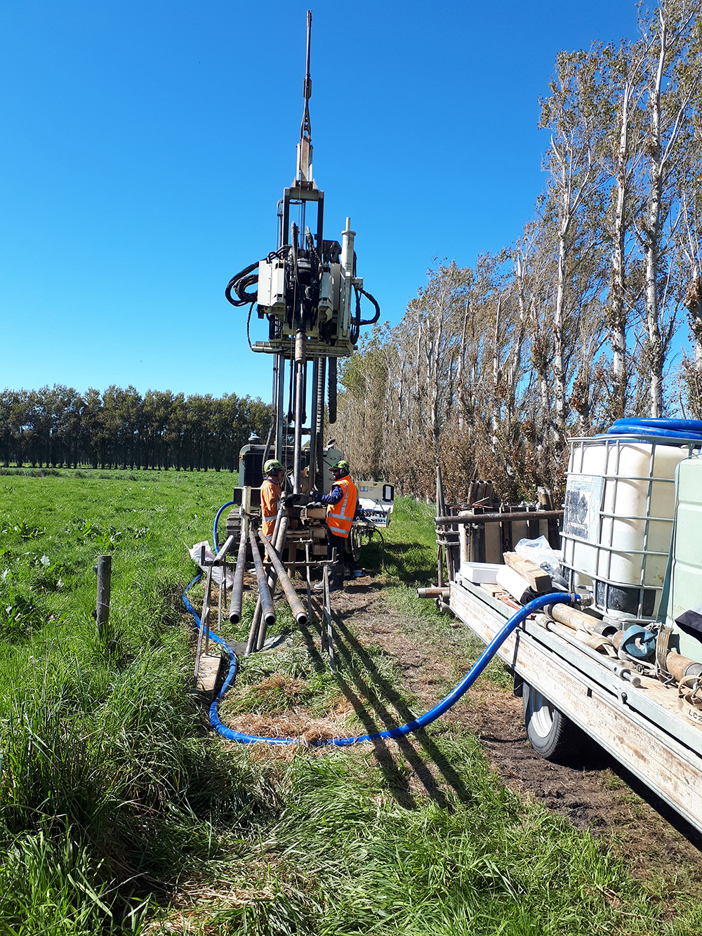
The Otago Regional Council’s Clutha Delta natural hazards work programme is continuing, with recent drilling work to install a network of groundwater level monitoring bores at Paretai, Inch Clutha, and Kaitangata completed.

Part of ORC’s wider body of climate change work, the groundwater drilling project is intended to inform natural hazards mitigations by painting a clearer picture of the geological and groundwater characteristics at the Clutha Delta.

Natural Hazards Manager Jean-Luc Payan said adaptation to environmental and climate change is one of Otago Regional Council’s strategic priorities.

“Large parts of the lower Clutha Delta are within one metre of mean sea levels, meaning they are considered at risk of sea-level rise impacts due to climate change.

“This project will complement other ORC’s other natural hazards work at the Clutha Delta, which includes an investigation of coastal hazards like coastal erosion and storm surge flooding.”

The next step after drilling was to install monitoring equipment, Natural Hazards Analyst Tim van Woerden said.

“We’ll be installing groundwater data loggers and piezometers at four locations, which measure groundwater levels. Once this equipment is in place, we’ll start to see the first continuous monitoring of groundwater levels for the Clutha Delta area.”

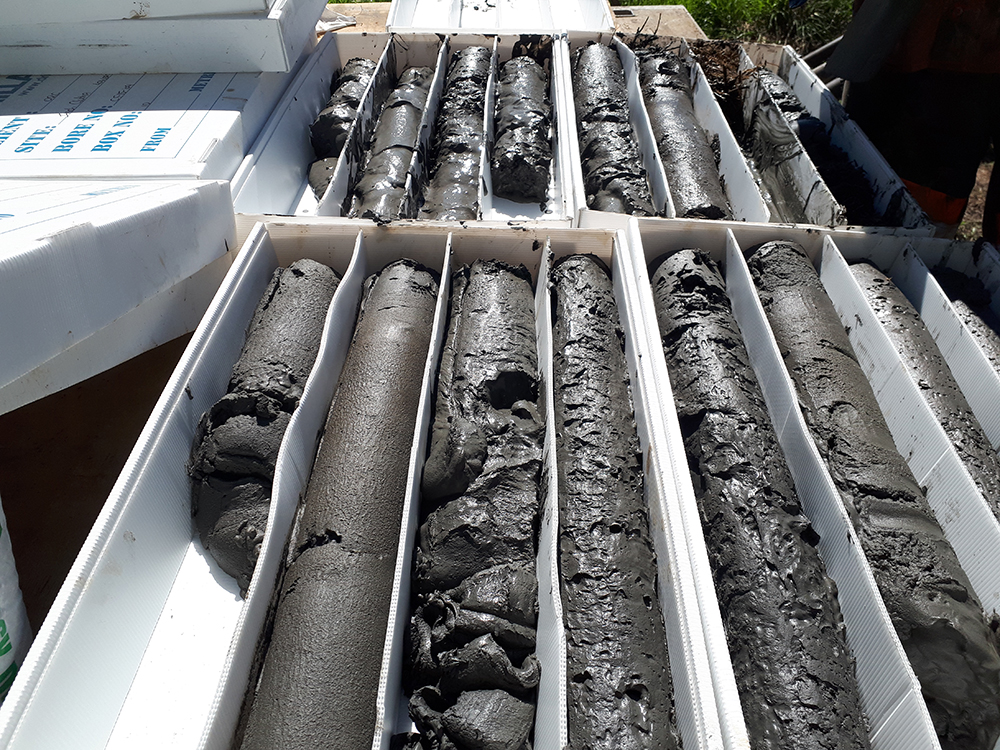
Information from the data loggers will give ORC a better understanding of groundwater movements beneath the surface, including the relationship between groundwater and river levels, rainfall and tidal variations. The sediments drilled were dominated by sequences of silts and sands, with intermittent gravel units, Mr van Woerden said.

“Most significantly for our climate change work, this project is a first step in understanding how projected sea-level rise will impact on groundwater levels, flooding hazards, and drainage capacity in the Clutha Delta.”

The Lower Clutha Flood Protection and Drainage Scheme, managed by ORC, provides flood protection and land drainage to 9300 ha in the area. ORC’s Infrastructure Strategy identifies Climate Change and Natural Hazards as two significant issues that will affect scheme performance in the future. Sea-level rise is a climate change issue which will be considered over the next few years as a review of the flood and drainage scheme performance is undertaken. This review will provide direction on the current levels of service of the scheme, and the options that may be required to adapt to the effects of climate change and coastal hazards, and future levels of service provided by the scheme.

Understanding environmental changes in the area, from climate change and other factors, is essential for future planning to continue providing flood protection and land drainage for the area in an efficient and sustainable way, Dr Payan said.

“The findings of this project will help ORC and the Clutha Delta community plan ahead for the future, allowing informed decisions to be made for the future management of land use, flood protection and land drainage infrastructure or other infrastructure.”

Drilling rig working at a Clutha Delta site on the Inch Clutha near Lawson Road (October 28 2021)

Drilling rig working at a Clutha Delta site on the Inch Clutha near Lawson Road (October 28 2021).

Drill core from a Clutha Delta site on the Inch Clutha near Lawson Road (October 28 2021)

Drill core from a Clutha Delta site on the Inch Clutha near Lawson Road (October 28 2021).

Back to top
Online Maps & Data: