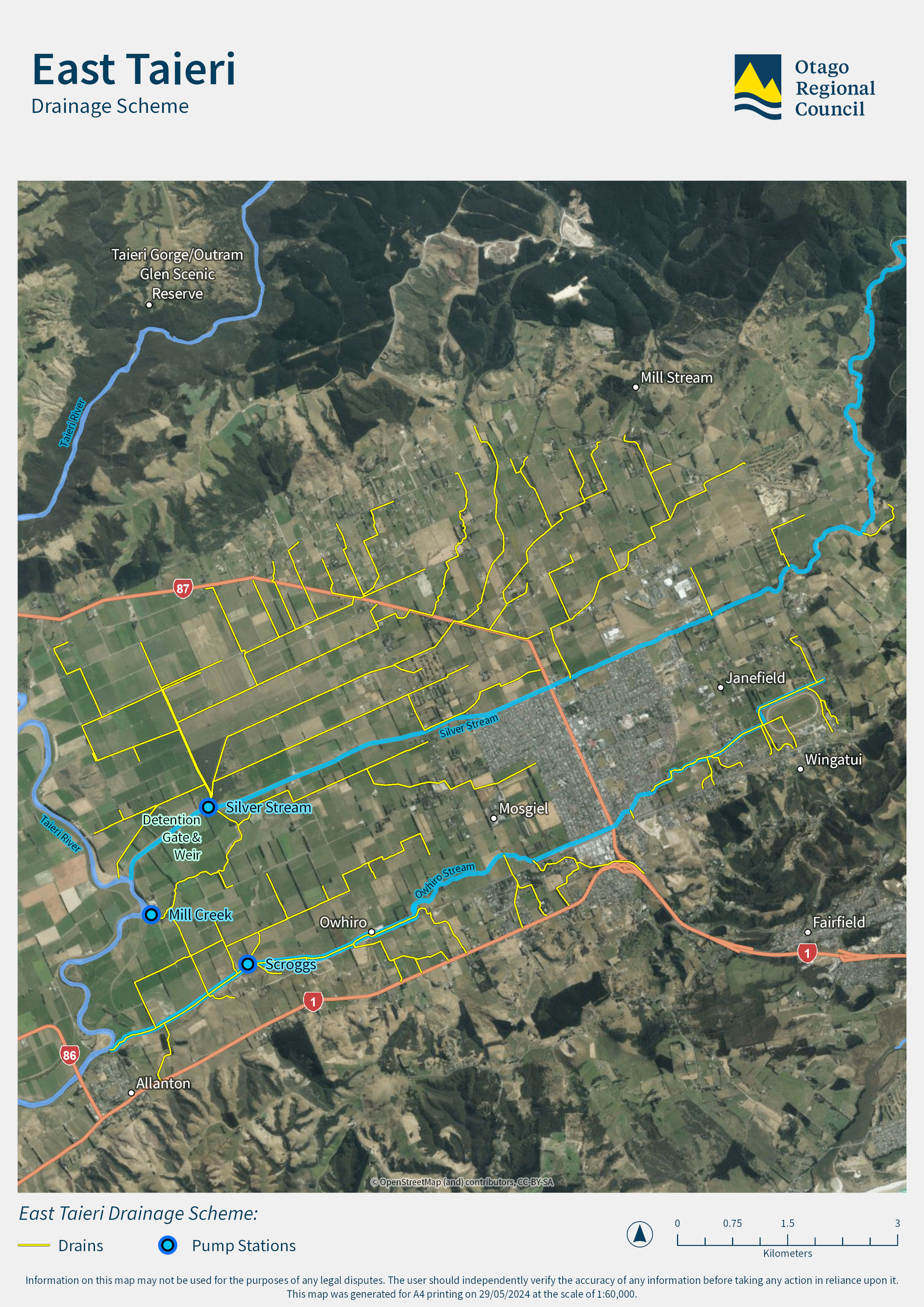
The East Taieri Drainage Scheme is split into two areas by the Silver Stream, which flows south-west across the Taieri Plain. Drains on the northern side of the Silver Stream generally flow toward what is called the Upper Ponding area.
Drains on the southern side of the Silver Stream flow toward the Lower Ponding area. When the flow of the Taieri River is low, these drains flow out to the river by gravity. Gravity gates close and pump stations are used when flows in the Taieri River are high.

Operations and Rivers Work Programmes
The Engineering Team at Otago Regional Council undertake annual programmes of work, to manage water flow in waterways around Otago.

Lower Taieri Flood Protection and Drainage Scheme Liaison Group
The Lower Taieri Flood Protection and Drainage Scheme Liaison Group connects the Otago Regional Council with local communities to improve flood protection and drainage in the Lower Taieri area, helping keep people and properties safer from floods.
Lower Taieri Flood Protection Scheme
The Lower Taieri Plain has a long history of flooding, and development of drainage and flood protection works goes back to the early 1900s.

West Taieri Drainage Scheme
The West Taieri Drainage Scheme, part of the Lower Taieri Flood Protection Scheme, is bordered by the Taieri River, Lake Waipori, and the West Taieri Contour Channel. Unlike other schemes, it relies entirely on pump stations at Waipori, Henley, and Lake Ascog due to its low elevation, often at or below sea level.


