The Lower Clutha flood protection and drainage scheme is a "combined scheme"
This scheme mitigates the risk of flooding and helps drain land in the Lower Clutha Delta, which extends from 4 km upstream of Balclutha to the sea. The combined flood protection and drainage scheme covers an area of approximately 9,300 hectares.
Construction of this scheme began in 1960 and was completed in 1991. The Clutha River/Mata-Au is the second longest river in New Zealand, and the largest by mean flow. Its headwaters are in the Southern Alps above lakes Whakatipu, Wānaka and Hāwea. The Clutha River splits into two just downstream of Balclutha. Between 60% and 70% of the flow goes down the Koau Branch and 30% to 40% down the Matau Branch. Between the branches is an island called Inch Clutha – at the top of this is a floodway (an area designed to carry floodwaters when the river level rises).
Water also flows into the delta from other sources, including Lovells Stream and Lake Tuakitoto, Waitepeka River, Puerua River and Barrata Creek. The scheme has a network of 153km of drains in four regions: Barnego, Stirling/Kaitangata, Inch Clutha, and Otanomomo/Paretai. The ORC doesn’t own or operate drainage in Balclutha and Finegand.
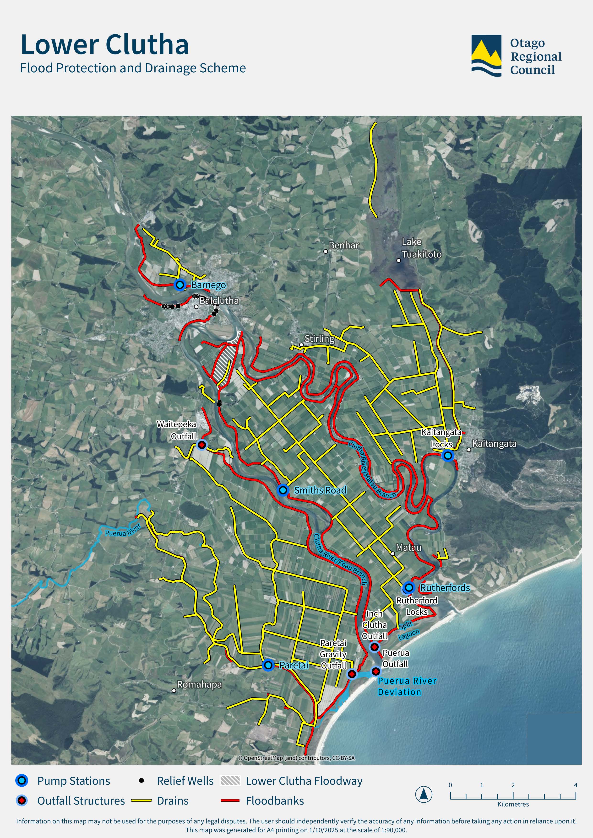

Operations and Rivers Work Programmes
The Engineering Team at Otago Regional Council undertake annual programmes of work, to manage water flow in waterways around Otago.

Lower Clutha Flood Protection and Drainage Scheme Liaison Group
The Lower Clutha Flood Protection and Drainage Scheme Liaison Group connects the Otago Regional Council with local communities to improve flood protection and drainage in the Lower Clutha area, helping keep people and properties safer from floods.

Clutha River
NIWA (now Earth Sciences New Zealand) was commissioned to undertake an assessment of the river morphology – the shape of the river channel and how it has changed through time.


