ORC’s Manager Engineering, Brett Paterson, says the Puerua Outfall Structure Upgrades will strengthen key flood protection infrastructure at the mouth of the Puerua River, where it meets the Koau branch of the Clutha River.
“The project focuses on the river training line and its culverts, which control river flows to the sea and prevent the river mouth from shifting along the coast,” Mr Paterson says.
Earlier flood events and ongoing coastal erosion have damaged these structures, reducing their effectiveness.
The project was started in November last year and is due to be completed by mid-October.
“The work is progressing well, and is on target to meet the planned timelines,” Mr Paterson says.
SouthRoads is the main contractor on site for the works.
“The biggest challenge on this site is the environment itself. Dealing with the Clutha, sea and side waterway; all working to the windows of tides and weather patterns,” Mr Paterson says.
“With the three water patterns in play the environment is always changing. The team on site have done an amazing job monitoring and dealing with any adverse effect of the changes,” he says.
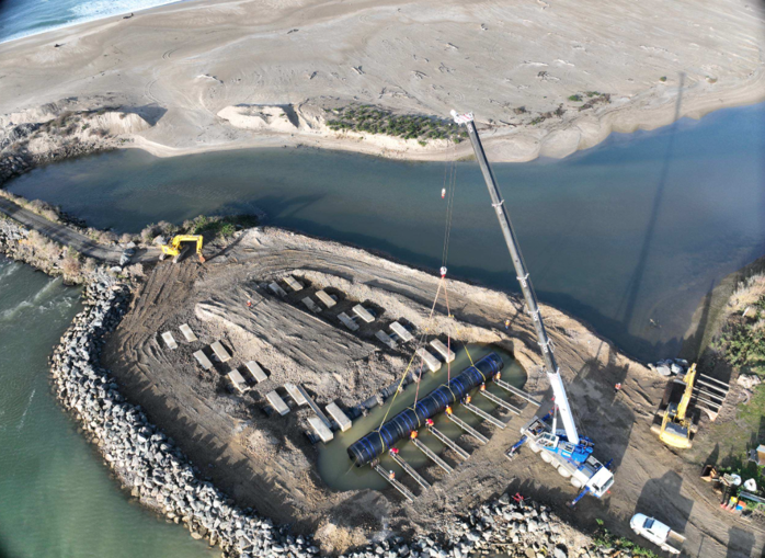
The $2 million project is being co-funded by a loan of up to $1.2 million from the Government’s Regional Investment Fund, which is administered by Kanoa – the Regional Economic Development & Investment Unit.
The project is a two-stage upgrade involving culvert installation and training line [rock walls] strengthening on the Lower Clutha, increasing levels of protection to Balclutha and Kaitangata areas.
“Upgrading the training line and culverts improves the system’s ability to handle future floods and cope with changing river flows caused by climate change,” Mr Paterson says.
The works to date replace the outfall culverts and upgrades to the training line wall to ensure reliable drainage and flood protection.
The improvements are designed to help maintain the Lower Clutha Flood Protection and Drainage Scheme’s performance, protecting the surrounding community, productive farmland, roads, rail lines, and other essential infrastructure in the district, he says.
The Lower Clutha flood protection and drainage scheme is in place to protect an area of approximately 9300 hectares and includes:
110 km of floodbanks
153 km of open drains
189 culverts
Five pump stations
Four bridges
The scheme plays a vital role in managing flood risk and ensuring productive land use in the Lower Clutha area in Otago. The scheme extends from four kilometres north of the Balclutha township and ends at the sea. It was built over several decades between 1960 and 1991 to protect the towns of Balclutha, Kaitangata and Stirling as well as low-lying farmland.


