-
-
-
-
-
-
-
-
-
-
-
-
-
-
-
-
-
Old Dunstan Road Swamp
-
-
-
-
-
-
-
-
-
Old Dunstan Road Swamp
Description: None available
Type/Class: Swamp 2
Size: 5.72 ha.
Altitude: 520-560 m above sea level.
Approximate location: 6.5 km Northwest of the intersection of Old Dunstan Road and Rocklands Road, Clarks Junction. NZTM (centre point): E1360100 N4941900
Regional Plan: Water for Otago. Schedule 9 Regionally Significant Wetland, no.116, Map F52
Territorial Authority: Dunedin City Council.
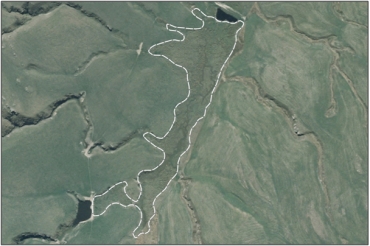
Interactive map of Old Dunstan Road Swamp
| Value | Description |
|---|---|
| A5 | Scarce in Otago in terms of its ecological or physical character. Less than 15% of swamps remain in Otago. 2 |
| A1- A4, A6-A7 | No relevant information is currently held by the ORC. |
2. Ausseil, A.G., Newsome, P., Johnson, P, (2008) Wetland Mapping in the Otago Region. Landcare Research
Was this page helpful?
Page last updated 7 August 2024
Page last updated 7 August 2024


