Kia ora and welcome!
In this issue: Puerua in the spotlight, planning for El Niño, and all about Cetaceans. So much good stuff, you'll have a whale of a time!
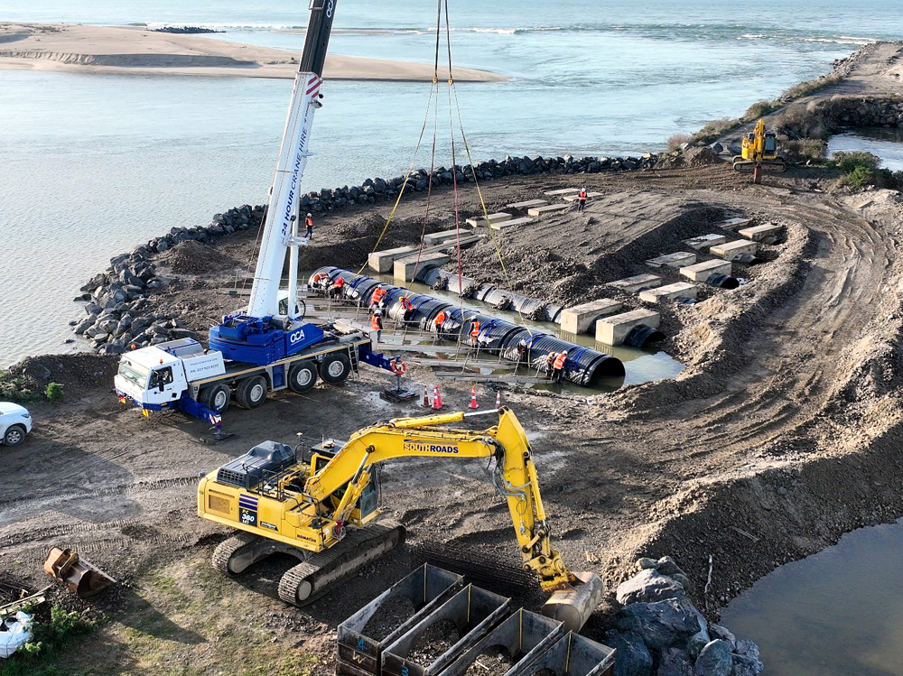
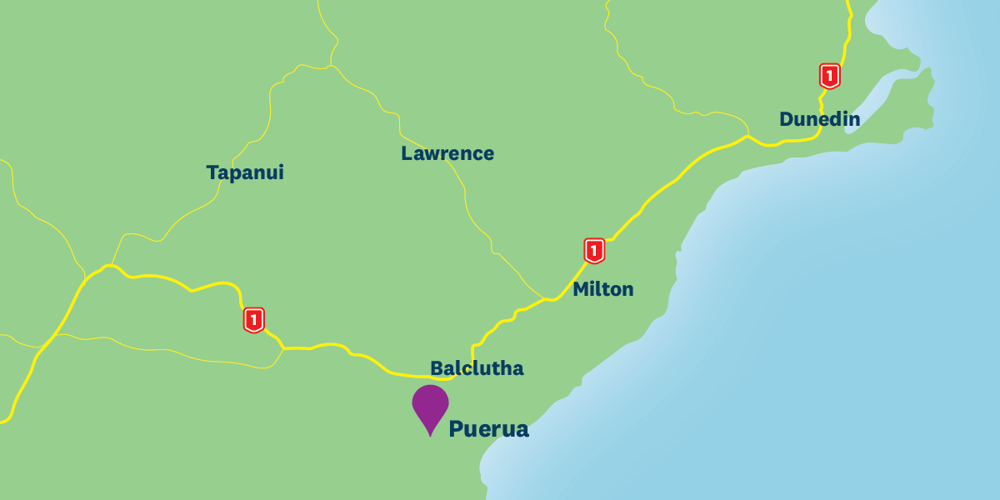
A $2 million upgrade to flood protection infrastructure at the mouth of the Clutha River south of Balclutha is nearing completion.
Improvements are designed to help maintain the Lower Clutha Flood Protection and Drainage Scheme's performance, protecting the surrounding community, farmland, roads, rail, and other essential infrastructure.
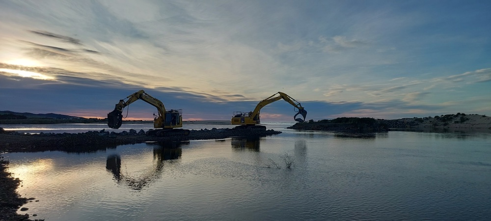
Work on the Puerua outfall structure includes upgrading culverts and strengthening rock walls, called training lines, on the Lower Clutha River/Mata-Au. The training lines and culverts control river flows to the sea and prevent the river mouth from shifting along the coast.
Earlier flooding and ongoing coastal erosion had damaged these structures, reducing their effectiveness. Work started in late 2025 and is due to be completed by mid-October. Weather and water have been the biggest challenges on site — monitoring the river and sea while keeping watch on tides and weather patterns has been a huge part of it.
The $2 million project is being co-funded by a loan of up to $1.2 million from the Government's Regional Investment Fund. Upgrading improves the system's ability to handle future floods and cope with changing river flows.
Lower Clutha/Mata-Au Flood Protection and Drainage Scheme
The Lower Clutha Flood Protection and Drainage Scheme is in place to protect an area of approximately 9300 hectares and includes 110 km of floodbanks, 153 km of open drains, 189 culverts, five pump stations and four bridges.
The scheme was built between 1960 and 1991 to protect the towns of Balclutha, Kaitangata and Stirling as well as low-lying farmland.
Flood protection and drainage rates will change for many urban and rural properties on the Clutha and Taieri flood and drainage schemes if proposed changes to how targeted rates are applied go ahead.
Changes are being proposed to better reflect who benefits — the changes would mean the amount properties pay for rates will depend on the level of benefit they get from the scheme.
The changes aim to share the costs more fairly and transparently across the properties that benefit from the schemes. Depending on location and the benefits received, targeted rates would change, and some properties could be added to or removed from scheme boundaries.
Generally, urban properties would see an increase in cost that better reflects the benefits they receive, while many rural properties would see a decrease.
Under proposed changes, flood and drainage rates would be separated and would be charged to better reflect the benefit that each property receives. That would see the flood protection rate each property pays based on the level of flood protection benefit it receives, while drainage rates would be based on the size of property, land use, and how that land uses affects the drainage network.
The proposal follows concerns raised from some parts of the schemes about the fairness of targeted rate collection for drainage and flood protection.
An interactive map showing the current and proposed boundaries and a rates estimator are online so people can see how this proposal would affect their property.
People can submit on the proposed changes until 11.59pm on Friday, 11 September 2026. Councillors will consider submissions before making a decision, and any changes to rates would not happen until 2027.
Residential property CV: $500,000 – land area: 750m² | ||
|---|---|---|
Current rates | Proposed rates 2027/28 | |
Mosgiel | $30 | $140 |
Outram | $720 | $140 |
Balclutha and Finegand | $510 | $590 |
Rural property CV: $2,000,000 – land area: 500,000m² | ||
Current rates | Proposed rates 2027/28 | |
East Taieri – 100+yr* area | $8,350 | $5,410 |
West Taieri – less than 10yr** area | $9,340 | $6,030 |
Inch Clutha | $5,780 | $5,730 |
Barnego | $6,120 | $4,810 |
*'100+yr' and 'less than 10yr' refer to the likelihood of flood / level of protection. Learn more at orc.govt.nz/schemerates
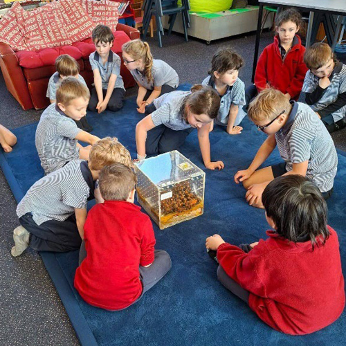
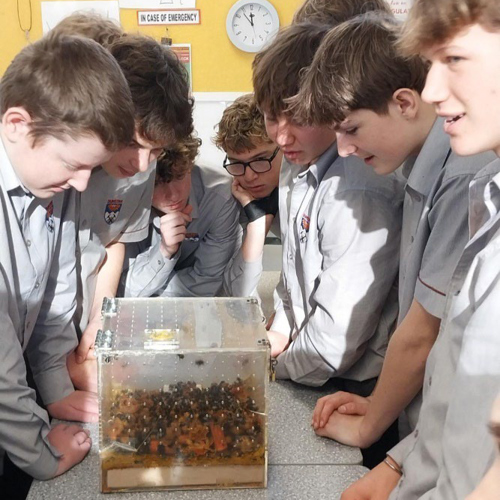
What’s better than getting a B at school? Getting bees at school!
Central Otago students at 11 Enviroschools schools recently experienced bumblebees up close — thanks to the New Zealand Bumblebee Conservation Trust. The trust supplied a hive for Enviroschools to take on tour so ākoka can get an up-close look at one of our bumblebees — something that usually doesn't happen because their hives are underground!
The schools are now looking to see how they can create safe spaces to encourage bumblebees back to their gardens — a wonderful way of showing kaitiakitaka for this awesome little pollinator. This will strengthen learning, build confidence in ākoka and support crucial systems in our environmental biodiversity.
A massive thank you to Jennie, our Ōtepoti facilitator, for her incredible energy and enthusiasm bringing this roadshow to life!
To contact the Enviroschools team, email enviroschools@orc.govt.nz
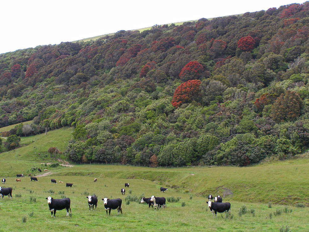
Jan and Roy have been living in the Puerua Valley, The Catlins, since 2008. Jan is a retired Telford Polytechnic tutor and Roy is a retired geothermal resource scientist. They run sheep and have a hazelnut orchard with a backdrop of native forest in a QEII covenant. “Some of the totara may be in the order of 2000 years old,” says Roy.
“We began trapping around our property in 2009 after obtaining some Fenn traps which DOC (Department of Conservation) were throwing out. The trap network has expanded considerably, to about 100 traps deployed. The focus originally was on rats and mustelids, but we now target mice, feral cats and possums. All our trap records are entered into the Trap NZ database — to date we have about 2300 entries.”
This trapping enthusiasm has expanded to the neighbouring Green Park Scout Camp, a nearby relative’s farm, and two nearby large native forest blocks. The Puerua Trappers have also put traps into the Awakiki Reserve, close to the Owaka Highway, under agreement with DOC.
Korimako/bellbirds and tūī have always been present in the Puerua Valley, but the numbers have increased significantly since Roy and Jan got to work removing pests. Tūī nest locally and in the hazelnut trees. Jan saw 26 tūī emerge from a tōtara tree a few years back.
“Springtime is when we get an influx of kererū — we have observed up to 67 in one large matsudana willow tree in our orchard shelter belt. It was like a dynamic Christmas tree with birds hanging off branches all over.”
Kārearea / New Zealand falcons and kāhu / harrier hawks are frequent visitors, as are riroriro / grey warblers and miromiro/tomtits.
“Rātā flowering has been subdued in recent years, which we believe is due to an increase in possum numbers. Rātā that we planted in a neighbouring property now get regularly munched,” says Roy, who is, however, predicting a blooming future.
The Puerua Trappers were among the 28 groups awarded funding from ORC’s ECO Fund this year, and this funding will help to increase trapping in the area.
“The ORC ECO Fund funding will be used for additional traps targeting possums and feral cats (104 have been caught to date) in the 93-hectare QEII covenant belonging to our neighbours. We are looking forward to additional increases in native bird numbers and more spectacular flowering of rātā and kōwhai.”
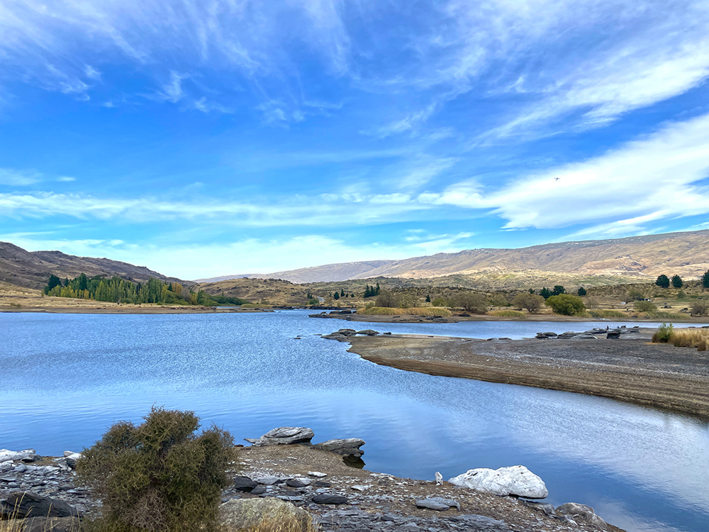
Otago communities — both rural and urban — are being encouraged to consider the effects of a predicted ‘significant El Niño’ weather event in late-spring early-summer this year, which could exceed some of the strongest El Niño events on record for Otago and affect town and irrigation water supplies.
Both the heavy rainfall and drought events associated with El Niño years in Otago can have significant impacts on agriculture and households.
For the rural sector, considerations should include grazing options, feed availability, back-up fuel, fixing leaky irrigation systems, stock plans for dry conditions on farms, and how potential water restrictions may impact farms and households.
For households and businesses, they can consider preparedness plans in case of adverse weather or drought conditions. Household preparedness for extreme weather events includes refreshing emergency supply kits containing food, water, torches and a battery-powered radio.
People can monitor the developing conditions through Earth Sciences' seasonal climate outlooks and drought forecasting dashboard.
For farmers, there is guidance on preparing for El Niño events available from the Ministry for Primary Industries.
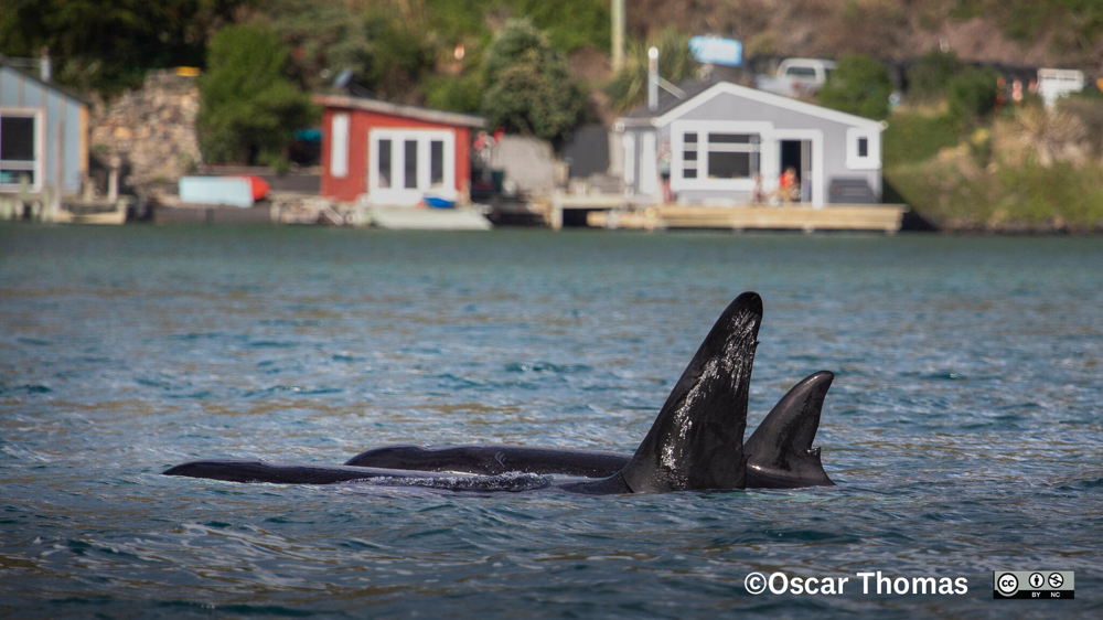
Over 30 different species of whales, dolphins and porpoises have been recorded in Otago. Marine mammals, like us they breathe air, are warm-blooded, give birth to live young and nurse them with milk.
‘Cetaceans’ is the collective name for whales, dolphins and porpoises, who between them form a single group, known as an order. Cetaceans can be divided into two living suborders:
Toothed whales, which have teeth, though these may not always be obvious. These whales use sound waves in a method called echolocation to navigate and hunt for fish and squid. Of this suborder, the largest group is the dolphin form, which (rather confusingly) includes maki/orca or killer whales, as well as the pilot whale. Other Aotearoa New Zealand examples include sperm whales and beaked whales.
Baleen whales, which have plates of baleen suspended from the roof of their mouths, through which enormous quantities of krill are sucked from the water. These whales are generally larger than toothed whales and include the largest whale of all, the blue whale. Aotearoa New Zealand examples include humpback and tohorā / southern right whales.
In Aotearoa New Zealand we have one endemic cetacean, the Hector's dolphin, meaning it lives and breeds only here. Hector’s dolphins have two recognised sub-species: Hector's dolphins and Māui dolphins, which is the name given to the North Island population.
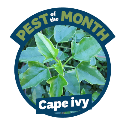
Why is cape ivy a pest?
Don't be fooled by its cheerful yellow flowers — cape ivy is a real garden bully. It smothers ground and low-growing plants by forming thick, long-lasting mats that block native seedlings from growing. On top of that, it produces masses of long-living seeds that can spread far from the parent plant, helping it pop up in all the wrong places.
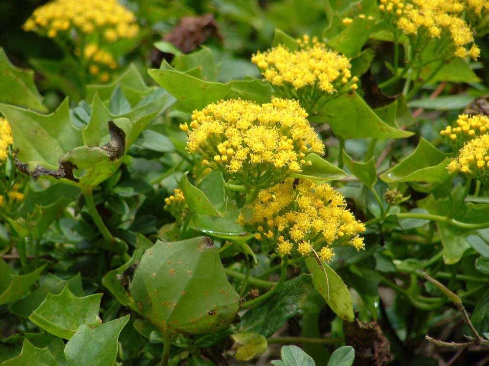
What does it look like?
Size: Cape ivy forms a thick, tangled shrub growing 2–3 metres tall.
Leaves: Cape ivy has fleshy, leathery leaves with one to three rough points on each side, with upper leaves smaller, narrower and sometimes smooth-edged.
Flowers/seeds: Cape ivy produces clusters of yellow ragwort-like flowers about 11 millimetres in diameter, followed by fluffy seeds.
Distinctive feature: Cape ivy has scrambling, wiry-to-woody stems that form dense, tangled growth.
Habitat: Cape ivy is found mainly in the Dunedin city and Otago Peninsula areas, with 85 known sites.
What should I do?
Physical control:
Slash any small infestations and hand-pull any regrowth.
Chemical control:
Cut the stump near the ground and paste it with a suitable herbicide gel containing either metsulfuron, triclopyr or glyphosate.
Spray foliage using a glyphosate-based product with penetrant.
CAUTION: When using any herbicide or pesticide, PLEASE READ THE LABEL THOROUGHLY to ensure that all instructions and safety requirements are followed.
Learn more about how to spot cape ivy on our Pest Hub.

Customer satisfaction with Otago’s public transport networks remains strong, with 89% of Dunedin passengers and 91% of Queenstown passengers satisfied with the overall service.
The results of a recent public transport survey show passengers are having positive experiences using ORC’s buses, particularly around safety, comfort, accessibility and interactions with drivers.
In Dunedin, overall satisfaction was 89% in 2026, compared with 90% in 2025. In Queenstown, overall satisfaction was 91% in 2026, down slightly from 92% in 2025.
Passengers in both centres rated several aspects of the service highly, including ease of getting on and off the bus, current trip satisfaction, driver helpfulness, comfortable temperature, personal security and seat availability — all rated 90% or higher.
Areas identified for improvement included on-time performance and information about services and delays in both Dunedin and Queenstown. Service frequency and value for money were also areas of improvement identified in Queenstown.
The results will help inform ongoing improvements to public transport services.

Find out about upcoming community events and Council meetings here
Feel free to forward this email to anyone who might like to read it. If you have any story ideas or want to know anything specific about anything in this issue, let us know by emailing onstream@orc.govt.nz


