-
-
-
-
-
-
-
-
-
The Source - Spring
-
-
-
-
-
-
-
Kia ora and welcome to our spring issue

How might Otago be impacted by natural hazards and what can we do to ensure communities are prepared?
These are important questions for our region, and something we’re working to better understand.
The recent magnitude 8.8 earthquake near Russia and subsequent tsunami advisory for coastal Otago were a reminder of the importance of being prepared — both in how we respond in a civil defence emergency, and in the work to understand the natural hazard risks already present.
It’s a big piece of work. Otago faces a number of natural hazards, and some of these are expected to
increase in frequency and severity in the future due to climate change and sea level rise.
Earlier this year we completed a region-wide analysis of how communities are exposed to natural hazards. In a number of communities across Otago, we have studied hazards in more detail and worked with communities to grow understanding of the risks. We also want to know what is important to these communities so we can work with them to develop a response.
This work includes looking at hazards in areas such as South Dunedin, the head of Lake Whakatipu, Middlemarch and the Clutha Delta. ORC staff will also be talking to people in North East Valley (Dunedin) and Roxburgh in the near future about natural hazard risks in those areas.
Working together to understand the risks we face from natural hazards is really important — it helps
build a picture of what the future could look like and enables communities to prepare. By looking ahead
we can be better informed, and our communities can be more resilient in the face of future natural
hazard events. Find out more about this work: orc.govt.nz/naturalhazards
After legislation was passed in October 2024 preventing the notification of the draft Land and Water Regional Plan, the Otago Regional Council has been proactively working with the Government to find a way to provide some certainty for farmers, growers, and water permit holders until a new plan is in place.
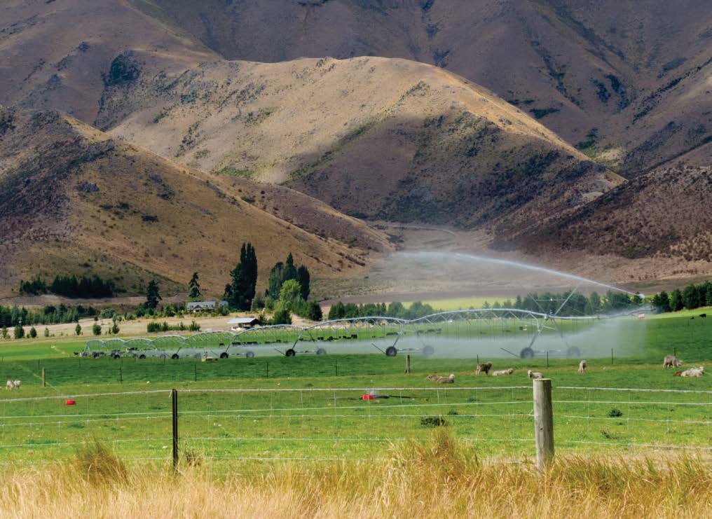
The consequences of delaying notification of the plan included uncertainty around achieving compliance with existing discharge rules, resulting in the need for many farmers to apply for resource consents.
Water permit holders would also be faced with a complex planning regime when replacing expiring water permits.
Council requested that the Government consider a legislative fix for these issues, extending the expiry date of existing short-term water permits for another five years and overriding certain discharge provisions of the Regional Plan: Water for Otago.
ORC Chair Gretchen Robertson says, “I’m very pleased that we have gained support from the Government to address these known issues through a change in legislation.
“While this only provides some further short-term certainty for the Otago community, it ensures we avoid unnecessary costs and regulation until new freshwater rules are in place.”
For more information, visit: orc.govt.nz/waterplanfaqs

As you’ve probably heard, local government elections are this October. Research the candidates vying for a seat at the council table, then vote from now until October 11.
All the where, why and how of voting is on our website with the candidate profiles: orc.govt.nz/vote

Remember, voting is by STV these elections
So rank your favourites. If you don’t want to see a candidate elected, don’t rank them.
Catchment advisor Polly recently teamed up with our biosecurity crew to investigate a possible pest plant in a local creek after receiving a citizen scientist’s report.
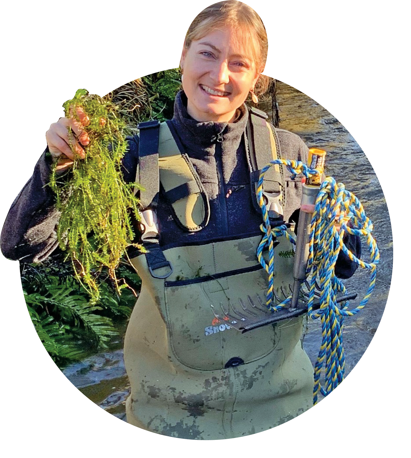
With a trusty rake they spent the morning in South Otago checking for Egeria, an invasive freshwater weed. The good news? No Egeria was found on this trip.
Spot something in your area that could be a pest? Use our new report a pest form, visit: orc.govt.nz/reportpests
Central government requirements to increase the proportion of public transport funding from fares means we’ve had to put them up.

From 29 September, adult fares will rise from $2 to $2.50 and 5–18-year-olds will pay $1.50 in both Dunedin and Queenstown.
SuperGold remains free during off-peak hours and will be the new adult fare of $2.50 in peak hours. The Community Connect discount remains at 50% and will be half the new adult fare at $1.25.
You’ll need a registered Bee Card to get these fares. All cash fares remain unchanged. Queenstown ferry fares and Queenstown Airport cash fares remain the same.
For more information, visit: orc.govt.nz/farechanges

Are you subscribed to our monthly e-newsletter On Stream? Would you like to be?
If you love the Whakatipu Waimāori / Lake Wakatipu, Wānaka, Hāwea and Waiwhakaata / Lake Hayes catchments as much as we do, you’ll be glad to know that a long-term plan is underway to protect their future.
 The Upper Lakes Catchment Action Plan centres on protecting and enhancing 13 ecosystems — covering the area’s major freshwater, terrestrial and modified habitats and resources.
This plan builds on the work that mana whenua, communities and local government are already doing to protect and manage their place and serves as a focus for new actions and projects. To learn more about the Upper Lakes Catchment Action Plan, visit: orc.govt.nz/upper-lakes or email us at icm@orc.govt.nz
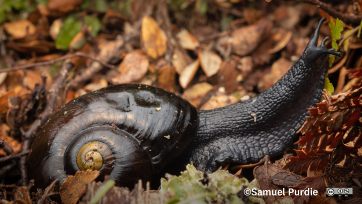
One of Otago’s two species of carnivorous Rhytididae snails, Powelliphanta spedeni can move surprisingly fast to grab prey with its mouth.
Once the prey is enveloped and suffocated, it is torn apart by the snail’s sharp, rasping teeth. These teeth, known as radulae, sit in a deadly ribbon in the snail’s mouth.
All land snails have radulae, not just the carnivores. For example, the common garden snail has over 14,000 teeth, which it uses to eat plants. Other snails use their radulae to break down decaying plant matter.
For more snail facts, slide over here: orc.govt.nz/snails
 Ryan from our environmental monitoring team recently braved -5°C temperatures to collect important river health data from our site at the head of the Manuherekia near Oteake Conservation Park, above St Bathans.
He spent nearly an hour in icy water where anything taken out of the water instantly froze! Talk about dedication to science.
We measure air pollutants at many sites across Otago to track air quality trends and have recently added two new tools to our network.
 One is a mobile air quality trailer (pictured, above right, in Albert Town Reserve, Wānaka). Data from this site will be compared with readings from our permanent monitoring station in Wānaka township to better understand how factors like housing density, topography, and wind affect concentrations.
The latest addition to our air monitoring network was installed in Frankton, Queenstown, earlier this year; a new permanent monitoring station at Kawarau Falls Playground (above left).
It measures PM2.5 from sources such as wood burners, vehicles, and industrial activities. Data from the sites will be published on the LAWA website in the coming months, alongside results from ORC’s other stations.
Have you seen a rook? What about a Mediterranean fanworm?
Our new report pests form is a quick way to alert our Biosecurity team to priority pests or any potential
biosecurity threats in Otago.
 Our region is home to many threatened and taoka species. We can help protect these and the region’s wider indigenous biodiversity if we all work together, especially if biosecurity staff have timely information on pest sightings and exact locations.
The form can be found on the report pests page of the ORC website and collects pest sighting details and precise location data.
Just like deer, rabbits, possums and wallabies, rooks were misguidedly introduced to Aotearoa New Zealand (between 1862–1873 to control insects) and spread in a bad way.
Larger than a magpie and with a distinctive ‘kaah’ call, rooks are attracted to recently cultivated paddocks and will feed on newly sown crops, causing significant damage.
ORC and Environment Southland have worked hard to eradicate these pests, pushing rooks down to very
low numbers from many thousands of breeding pairs in the 1980s and 1990s.
Southland is now rook free, while the birds continue to be sighted in Otago. Look out for them in spring when they are most active — but don’t disturb them, report them.
To report a sighting or for more information on rooks, go to: orc.govt.nz/rooks
Otago Regional Council is undertaking a bathymetric coastal survey in Molyneux Bay to observe seafloor elevations around the 6500-year-old ‘sand wedge’ made up of sediment from the Clutha River/Mata-Au.
 ORC’s Natural Hazard Analyst, Julion Wright, says the survey is to determine the current dimensions of the coastal Clutha “sand wedge” deposit, which ultimately spills sediment into the Southern Ocean.
The survey uses a singlebeam echo sounder aboard the University of Otago’s 6.5-metre aluminium boat RV Tūhura (right), travelling about 180 kilometres over a week.
ECO Fund recipient the Matukituki Charitable Trust was established in 2013 by Derek and Gillian Crombie when they noticed kea numbers plummeting while tramping in the West Matukituki Valley.
The trust’s vision is to minimise the predator population in the valley and restore the native species under threat, including the South Island robin, South Island kākā, kākāriki, rock wren, whio, South Island long-tailed bat, giant wētā and up to six species of lizards and scarlet mistletoe.
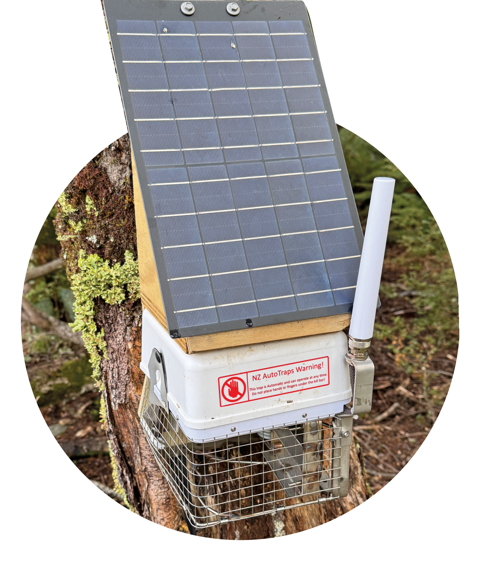
The trust also aims to provide an environment that enables the release of mohua and possibly kiwi, and other species that used to inhabit the valley.
The number of traps for rats and stoats being serviced currently is 858. The trust has also continued a targeted programme trapping feral cats and possums.
A typical year achieves a kill of between 800 to 1500 predators, including stoats, rats, cats and possums. We’re proud to support them with ECO funding for new AT520 traps.

 Teaming up with Enviroschools, catchment advisor Janice goes above and beyond to illustrate that what goes down the stormwater drain ends up in our water — part of the Adopt a Drain programme

As part of an Enviroschools visit, Macandrew Bay School juniors talk about what can go down the drain — only rain

Are you subscribed to our monthly e-newsletter On Stream? Would you like to be? Get ORC’s monthly news fresh to your inbox: