-
-
-
-
-
-
-
-
-
-
-
-
-
Island Blocks Pond Marshes
-
-
-
-
-
-
-
-
-
-
-
-
-
Island Blocks Pond Marshes
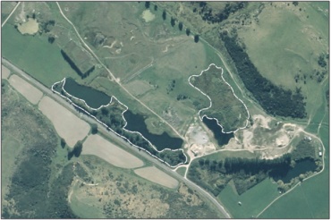
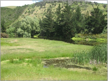
Description: Island Blocks Pond Marshes
Type/Class: Marsh 2
Size: 3.59 ha
Altitude: 60 - 80 m above sea level
Approximate location: 1.7 km Northwest of the intersection of Ettrick-Raes Junction Road and McCunn Road, Ettrick | NZTM (centre point): E1325380 N4928840
Regional Plan: Water for Otago |Schedule 9 Regionally Significant Wetland, no.64, Map F15
Territorial Authority: Central Otago District Council
Interactive map
- Listed as an Additional Wetland in Schedule 19.6A of the Central Otago District Plan. 55
2 Ausseil, A.G., Newsome, P., Johnson, P. (2008) Wetland Mapping in the Otago Region. Landcare Research Contract Report prepared for the Otago Regional Council.
51 Otago Regional Council – Photo Archive
55 Central Otago District Council (2008) Central Otago District Plan, Published by Central Otago District Council, Alexandra.
Was this page helpful?
Page last updated 26 July 2024
Page last updated 26 July 2024


