-
-
-
-
-
-
-
-
-
-
-
-
-
-
-
-
-
Fernhill Marsh
-
-
-
-
-
-
-
-
-
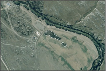
Fernhill Marsh
Description: None available
Type/Class: Marsh 2
Size: 0.7 ha.
Altitude: 180-200 m above sea level.
Approximate location: 2 km Southeast of Sutton. NZTM (centre point): E1376580 N4948450
Regional Plan: Water for Otago. Schedule 9 Regionally Significant Wetland, no.42, Map F51.
Territorial Authority: Dunedin City Council
The Fernhill Marsh has been removed from the Regional Significant Wetlands list. Previously mapped sections that were identified in the Regional Plan - Water for Otago don’t quality the NPS-FM (2020) wetland definition. However, other natural wetlands in the surroundings are being mapped and will be uploaded in the future iteration of the regional wetland inventory.
| Value | Description |
|---|---|
| A5 | Scarce in Otago in terms of its ecological or physical character. Less than 15% of marshes remain in Otago. '2' |
| A1-A4, A6-A9 | No relevant information is currently held by the ORC. |
2. Ausseil, A.G., Newsome, P., Johnson, P, (2008) Wetland Mapping in the Otago Region. Landcare Research Contract Report prepared for the Otago Regional Council.


