-
-
-
-
-
-
-
-
-
-
-
-
-
Timber Creek Seepage
-
-
-
-
-
-
-
-
-
-
-
-
-
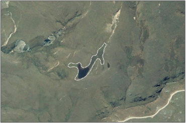
Timber Creek Seepage
Description: None available
Type/Class: Seepage 2
Size: 1.0 ha
Altitude: 760 - 800 m above sea level
Approximate location: 12.7 km Northeast of the intersection of Little Kyeburn Road and Danseys Pass Road, Naseby | NZTM (centre point): E1390480 N5018590
Regional Plan: Water for Otago | Schedule 9 Regionally Significant Wetland, no.152, Map F11
Territorial Authority: Central Otago District Council
Interactive map
| Value | Description |
|---|---|
| A4 | High degree of wetland naturalness. 2 |
| A1 - A3, A5 - A9 | No relevant information is currently held by the ORC. |
2 Ausseil, A.G., Newsome, P., Johnson, P. (2008) Wetland Mapping in the Otago Region. Landcare Research Contract Report prepared for the Otago Regional Council.
Was this page helpful?
Page last updated 26 July 2024
Page last updated 26 July 2024


