-
-
-
-
-
-
-
-
-
-
-
-
-
Middle Swamp
-
-
-
-
-
-
-
-
-
-
-
-
-
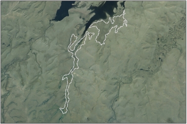
Middle Swamp
Description: Middle Swamp
Type/Class: Bog 2
Size: 66.4 ha
Altitude: 700 - 720 m above sea level
Approximate location: Southern margin of Lake Onslow, 23 km Southeast of Roxburgh | NZTM (centre point): E1335370 N4947950
Regional Plan: Water for Otago | Schedule 9 Regionally Significant Wetland, no.104, Map F27
Territorial Authority: Central Otago District Council
Interactive map
| Value | Description |
|---|---|
| A4 | High degree of wetland naturalness. |
| A1 - A3, A5 -A9 | No relevant information is currently held by the ORC. |
- Composition of red tussock (Chionochloa rubra) and Carex sp. 2
Was this page helpful?
Page last updated 26 July 2024
Page last updated 26 July 2024


