-
-
-
-
-
-
-
-
-
-
-
-
-
-
-
-
-
-
-
-
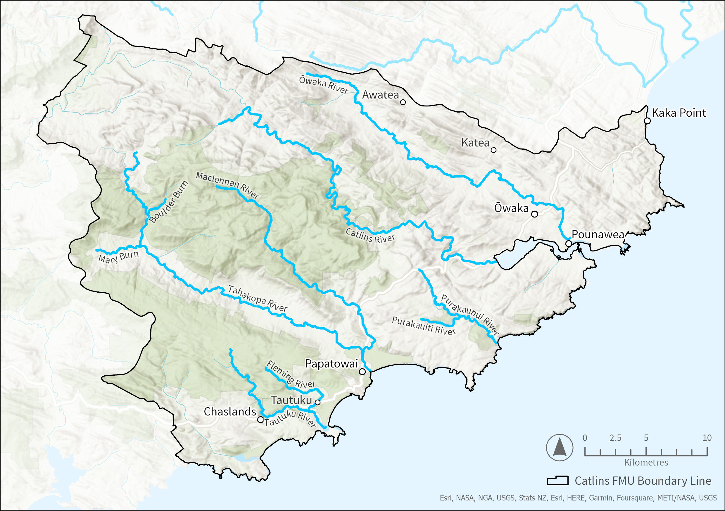
Catlins FMU
-
-
-
-
-
-
-
-
-
-
-
-
-
-

The Catlins Freshwater Management Unit (FMU) runs along the southern coast of Otago.
With extensive conservation land and rainforests, it is a popular holiday destination, and the population expands in summer and over long weekends. The Catlins contains many unmodified river, coastal and estuarine ecosystems, including an extensive spread of indigenous land cover. The landscape is made up of low ridges running in a north-west/southeast direction which supports the native forest and high-producing grasslands.
The climate is more temperate than inland Otago with high and reliable annual rainfall, which usually provides ample water supply.
Land use in the Catlins includes sheep and beef farming, minor dairy grazing and a sizeable (and growing) forestry industry. This mostly occurs in the valleys and hill country.
In 2018, the Catlins FMU was home to around 1,600 residents. In the 12 years between 2006 and 2018, the population decreased by 4%, in contrast to the Otago region as a whole, which rose 16%. Most Catlins residents live rurally, and nearly 40% of the population live in the Owaka, Kaka Point, or Pounawea townships.
Water resources are essential to the Catlins local community and economy. Most Catlins workers are in the agriculture or tourism sectors, which are closely tied to the area’s natural resources, such as biodiversity, landscapes, freshwater and soil.
It is important to understand Māori history and the Māori economy when developing policy and assessing its impact. Pre-European Māori history shapes today’s Aotearoa, and the Māori economy is integral to the national economic system. A report prepared by Aukaha, with support from ORC, provides a Kāi Tahu assessment of the socio-economic impacts of freshwater management in Otago.

The dominant soil is brown soils and podzols. Brown soils occur with moderate structure and drainage making these soils suitable for cultivation. Podzols occur where acid leaf litter and high rainfall combine, mainly in indigenous forest. They have low natural fertility and root growth and require fertiliser for grassland farming.
Catlins FMU land use summary
The Catlins usually has more water than is needed, as rainfall is high and evapotranspiration low. We use observed flows to decide on allocations rather than calculating naturalised flows.
ORC monitors flow in the Catlins and Owaka rivers, and we use hydrological modelling to estimate flows for other catchments. The main sources for water use are the Puerua River and Owaka River catchments, mainly for rural supply and dairy sheds. Water use compared to availability is the highest in the Puerua River catchment.
The headwaters and native vegetation have been left intact, which helps to maintain good water quality. However, cleared valleys allow intensive farming, and some of the parameters we monitor indicate that water quality is degraded. We monitor water quality and ecology for the Catlins River, Owaka River, Maclennan River and the Tahakopa.
We combine the results from this monitoring to indicate the state of a river or stream. For the Owaka and Tahakopa rivers, suspended fine sediment and E. coli results didn’t meet the national bottom line according to the National Policy Statement for Freshwater Management, and these rivers are categorised as degraded overall.
Trend analysis results for the Catlins River are mixed. The 20-year trend indicates a high likelihood of degrading water quality for most attributes, while the 10-year trend indicates likely improvements for many of the attributes.
Catlins FMU Water Quality State and Trends Technical Report
Introduction to water quality
Catlins FMU water quality summary
Most groundwater is hosted in fractured rock. This differs from most of Otago, where groundwater is mainly found in alluvial deposits. However, groundwater in the Puerua catchment is found in alluvium of the Lower Clutha delta.
Groundwater use in the Catlins is generally low, with only 20 completed bores in the area for community supply, stock, domestic supply and industry. There are only five consents to take groundwater, and the rates of take are low.
The Catlins has extensive freshwater biodiversity values including rare and threatened species, and vulnerable ecosystems such as ephemeral wetlands, dune slacks, estuaries, lake margins and wetlands. These ecosystems contribute a lot to national biodiversity, but are often threatened by processes such as land use change and invasive species. We know little about their extent and/or condition.
A diverse range of native freshwater fish, invertebrates, birds, plants and a bat depend on freshwater ecosystems in the Catlins. The 19 native freshwater fish are two eels, five bullies, four migratory galaxias (whitebait), lamprey, smelt, torrentfish, estuarine triplefin, black flounder and three non-migratory galaxias. The threatened freshwater fishes are non-migratory galaxias and the lamprey. Freshwater invertebrates are freshwater crayfish, freshwater mussels and shrimp.
Many native birds depend on freshwater ecosystems, either as permanent or mobile residents. Threatened birds are the Australasian bittern, the black stilt and the at-risk black-billed gull. Many plants are freshwater-dependent, including the threatened heart-leaved kohuhu. Introduced sports fishes are brown trout and perch. We do not have full information at a species level, particularly for freshwater invertebrates, non-vascular plants and algae. Many native freshwater species are under threat and continue to decline.
Estuaries are highly productive ecosystems but extremely sensitive to human activity. The Catlins contains four estuaries: Waipati/Chaslands Estuary, Tautuku River Estuary, Tahakopa Estuary, and the Catlins River Estuary. The Catlins River Estuary is most affected by human activity and experiences algal growth problems, increased sedimentation and poor sediment oxidation compared to the other three less-modified catchments.
The Catlins has some of Otago’s more unmodified estuaries such as the Tautuku and Waipati/Chaslands estuary which are fringed by native forest and contain a natural transition between estuary and dunes/salt marsh/wetland into native forest and low mud content. While some good examples of more “natural” estuaries exist, impacts from sedimentation and nutrients can accumulate and degrade these sensitive environments.

September 2024
Aukaha (1997) Ltd
PDF | 4 MB
This report provides a Kāi Tahu assessment of the socio-economic impacts of freshwater management in Otago, which speaks to the development of a new Land and Water Regional Plan for Otago (LWRP).

November 2022
PDF | 1 MB
Contact your FMU's Catchment Advisor for advice and assistance on sustainable land management practices that protect Otago’s waterways.
Sign up to our monthly newsletter On Stream for regular updates
Email customerservices@orc.govt.nz
Tel 0800 474 082